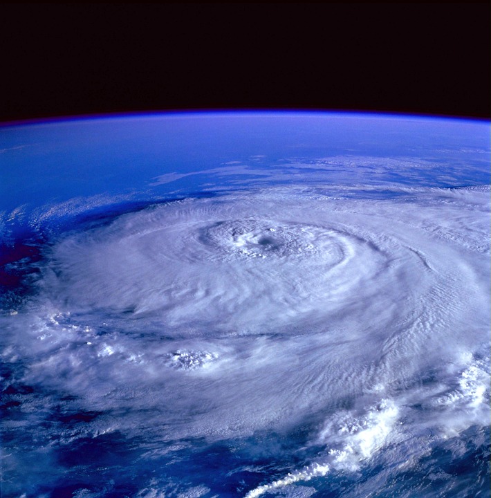
The Tech That Predicted Hurricane Florence
This past September, as Hurricane Florence bore down on the Atlantic coastline, researchers and forecasters were more prepared than ever before to deal with the daunting effects of the upcoming storm. While these destructive forces of nature will never be truly neutralized, cutting-edge observation systems have made predicting their effects, and making people safer, easier than ever. That’s not to say it’s a simple task.
While today’s satellites can predict typical weather conditions fairly accurately, patterns of hurricanes making their way over the ocean are a bit more complicated. Predicting a hurricane’s path is tricky, which is why scientists work hard to gather as much data as possible from each major storm to better predict the next one.
Over the past few decades, however, weather forecasters have been able to rely on the combination of satellite technology, advanced radar systems, and well-designed hurricane aircraft to bring about a clearer picture of hurricane and tropical storm behavior than ever thought possible. Today’s technologies allow researchers and forecasters to track a hurricane’s path and predict its size and force with a remarkably high degree of accuracy.
Up Close and Personal Data Collection
Accurately predicting the path and potential damage of a storm requires some truly up close and personal data collection that’d be far too dangerous for a human to conduct in person. To get the most valuable information available, researchers have a secret weapon about the size of a paper towel roll: the dropsonde. Dropsondes are designed by Vaisala, a company based out of Louisville, Colorado. These appropriately named devices are dropped out of high-altitude planes, directly into the hurricane to gather and send data about the storm to pilots and research labs.
Originally developed by the National Center for Atmospheric Research in Boulder, these tools, formally the Airborne Vertical Atmospheric Profiling System (AVAPS™) debuted in 1997 for operational weather forecasting and atmospheric research efforts.
Dubbed by the National Science Foundation ‘workhorses in hurricane forecasting’ dropsondes can withstand extreme hurricane conditions to provide accurate, useful data. Each dropsonde is relatively lightweight and loaded with sensors. They’re small and efficiently designed, capable of capturing data twice per second in the harshest conditions imaginable.
Released from airplanes straight into the storm, dropsondes fall to the ground quickly, making every second of data collection extremely precious. Developers attach a small parachute to each unit — slowing down the drop rate so the devices can accurately measure temperature, humidity, wind speeds, and other important data points. Back at the research center, scientists can extrapolate all the data to formulate detailed projections, adding to a body of knowledge that will one day predict hurricanes the way we can today forecast a sunny afternoon.
Tracking the Hurricane in real time
During Hurricane Florence, research scientists at NOAA’s National Severe Storms Laboratory were even able to launch high-tech weather balloons into the middle of the hurricane to capture data. Sensors inside the balloon helped scientists monitor Hurricane Florence as it made its way to the shore and transitioned from a hurricane to a tropical depression. This type of technology helps data scientists analyze various conditions before, during, and after the hurricane, track the hurricane’s path, and make accurate estimates and assumptions when building models.
The National Hurricane Center has a formal process in place for forecasting all types of tropical cyclone activity in the Atlantic and Pacific around North America and are responsible for communicating their forecasts every six hours. They use everything from satellites, aircraft, ships, buoys, radar devices, and land-based tools to track hurricanes and predict their paths as accurately as possible. Once a hurricane looks like it will make landfall and is identified as a real threat, it’s closely monitored by the U.S. Air Force and NOAA hurricane craft.
While the storms themselves can’t be stopped, high-tech data collection and analysis can greatly reduce the risk presented by each new storm, and influence building and city planning practices to further protect residents from these incredibly powerful weather systems. This high-tech development, perfected over time, will one day make hurricanes like Florence a much less daunting event. That’s an evolution worth applauding.
